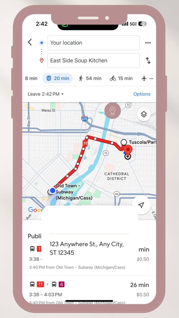
STARS bus routes and times are now available on Google Maps, making it easier for riders to plan trips around the Metropolitan Saginaw area. To get started, simply download the Google Maps application on your mobile phone, enter your destination, and hit the bus icon to see your path. It’ll show pickup times and bus stop locations for all bus route services.